Putting Kentucky on the Map
Clip: Season 31 Episode 17 | 8m 25sVideo has Closed Captions
A history of mapping the Commonwealth of Kentucky.
The Kentucky we know today wasn’t always so clearly defined. It had to be mapped one line at a time. From early trails and hand-drawn charts to today’s digital tools, each map has helped shape how we understand the land. Let's explore how the Commonwealth was drawn, and redrawn, over time.
Problems playing video? | Closed Captioning Feedback
Problems playing video? | Closed Captioning Feedback
Kentucky Life is a local public television program presented by KET
You give every Kentuckian the opportunity to explore new ideas and new worlds through KET. Visit the Kentucky Life website.
Putting Kentucky on the Map
Clip: Season 31 Episode 17 | 8m 25sVideo has Closed Captions
The Kentucky we know today wasn’t always so clearly defined. It had to be mapped one line at a time. From early trails and hand-drawn charts to today’s digital tools, each map has helped shape how we understand the land. Let's explore how the Commonwealth was drawn, and redrawn, over time.
Problems playing video? | Closed Captioning Feedback
How to Watch Kentucky Life
Kentucky Life is available to stream on pbs.org and the free PBS App, available on iPhone, Apple TV, Android TV, Android smartphones, Amazon Fire TV, Amazon Fire Tablet, Roku, Samsung Smart TV, LG TV, and Vizio.
Providing Support for PBS.org
Learn Moreabout PBS online sponsorshipBut first, the Kentucky we know today wasn't always so clearly defined.
It had to be mapped one line at a time.
From early trails and hand-drawn charts to today's digital tools, each map has helped shape how we understand the land.
Let's explore how the Commonwealth was drawn and redrawn over time.
[music playing] We have a very rich history when it comes to mapping, and there's a lot of people, I think, that aren't aware of that.
Folks really take maps for granted.
We've all got them on our phones.
We've got them on screens now.
But I don't think people really understand what goes into making those maps, where that information comes from, and how it impacts their lives.
To understand how Kentucky got her maps, we have to go back to an era when this land was being shaped by the knowledge and movement of Indigenous Peoples.
The trails that the Native people carved through Kentucky are the highways that folks like Daniel Boone will follow.
They become the foundation of what somebody, a mapmaker like John Filson, for example, in the 1780s is going to use.
And it's no surprise then that you see so many of those Native traces and trails on his map that he produces alongside the evidence of early Kentucky settlement.
[music playing] Filson is really important because he puts Kentucky on the map internationally.
And that really establishes Kentucky as the place on the earliest American frontier.
And you look at that map, and it is so incredibly detailed and rich.
This is why it's such an iconic piece, and I think struck so many people both then and subsequently as just beautiful art.
Yeah, cartography is an art.
There is an art to making a map.
There is an art to making it consumable, usable.
To make a great map that really communicates what you're trying to get across take some special skills, take some special eyes.
Mapping Kentucky is a physically demanding activity.
And that really doesn't change until the turn of the 20th century and arguably still going on today.
You have to physically traverse every inch of it.
It's absolutely incredible when you look at the surveying output of some of these early Kentuckians, who are walking over hundreds of miles and laying out huge tracks of land for the benefit of folks over across the mountain in Virginia.
[music playing] Then they're going to ship that information along with copious notes to an engraver in Philadelphia who's going to carve that into usually a stone and then cover that with ink.
And then, they're going to prepare that for printing.
[music playing] Thinking about the Barker maps, I have to think specifically to the one that we have in the Filson collection, which has been cut up and glued down onto a really heavy cloth backing as a travel map.
[music playing] Without knowing precisely who owned this map, there are just so many little hand annotations that I think tell us so much about the growth of Kentucky here.
So, we see cities that are being put on the map in ink as they're being established, right?
Cincinnati, Maysville, think about the intellectual labor that's gone into the surveys of the creeks and the rivers.
Locating the cities and the forts, the trading posts, but then also recognizing that as valuable as this map as a production is, its information is finite and it constantly needs to be updated.
This is a working tool for somebody that's going out and doing those surveys.
It's such an incredible story about the settlement of Kentucky right here.
The maps that we start to see produced at a scale that it really is unimaginable to us are mapping as the story of individual families claiming space and land here.
In the 1800s, they did start producing a lot of the larger scale maps like the Sanborn maps and stuff that are kind of showing individual buildings.
So, the measurements are all very accurate.
The widths of the streets are all kind of accurate.
While accuracy was increasingly becoming the focus of map making during the late 1800s, there was another style of map quickly gaining popularity, the bird's-eye view.
[music playing] They were maps that were basically promotional things for the cities.
Definitely more artsy than accurate.
Somewhat like aerial photography it's a snapshot in time.
And if you go back and you look at those old historic maps, the one of Bowling Green with the reservoir up on the hill or the one of downtown Frankfort that showed what Frankfort looked like before they tore down a whole neighborhood to put in the new transportation cabinet building.
They may be just a pretty picture, but there's information there.
[music playing] You know, of the 20th century maps, the ones that I tend to find myself using the most are tourist maps, especially as we move into the era of establishing state parks in the 1920s, 1930s.
As we start to build more highways, tourism and culture become a huge selling point for Kentucky.
They have these wonderful iconographic representations of what it is to be Kentucky.
By the mid-20th century, mapping in Kentucky entered a new phase.
Through a coordinated effort between the United States Geological Survey and the Kentucky Geological Survey, the entire state was systematically mapped using 7.5-minute topographic quadrangles, which show intricate details like elevation contours, rivers and roads, making Kentucky the first state in the nation to be mapped at this level of precision.
Those maps, they really became the gospel.
That was the authoritative map that everybody goes to.
We kind of became known as the best mapped state in the nation.
[music playing] LiDAR is light detection and ranging.
It's like a big scan of everything in the built-in natural environment.
Super dense sampling, so we can create elevation layers that have been more accurate than they've ever been before.
Kentucky was one of the first states in the nation to complete a Phase I LiDAR acquisition, and in 2024, we completed our second statewide acquisition.
[music playing] Most aerial photography is nadir, top-down view.
You're looking at the top of a roof.
But with obliques, there's also a sensor looking forward, backward, and to each side.
So, what you end up with is, is you end up with a view of every piece of ground in Kentucky from all four cardinal directions.
We may be first in the nation to get this, but if we don't keep it up to date, then it's a one and done thing.
Kentucky has now been mapped to a precision of three inches, an unprecedented level of detail, and highlights how far we've come since early surveyors and cartographers drew those first maps of the Commonwealth.
[music playing]
Video has Closed Captions
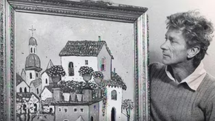
Clip: S31 Ep17 | 7m 49s | A look into the colorful world of renowned artist Henry Faulkner. (7m 49s)

Video has Closed Captions
Clip: S31 Ep17 | 5m 54s | Lexington's 250-year history can be observed on a walk down its Main Street. (5m 54s)
Providing Support for PBS.org
Learn Moreabout PBS online sponsorship


Support for PBS provided by:
Kentucky Life is a local public television program presented by KET
You give every Kentuckian the opportunity to explore new ideas and new worlds through KET. Visit the Kentucky Life website.